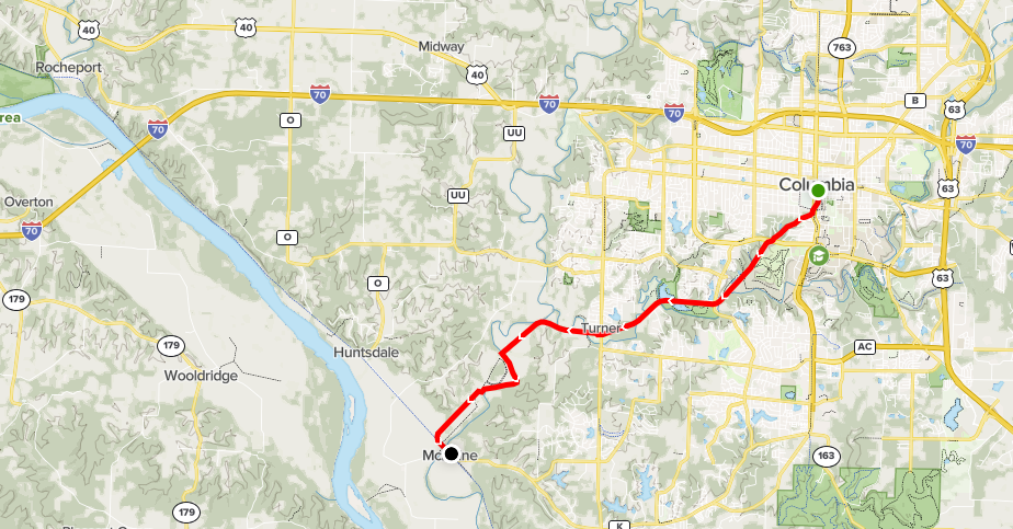
The MKT Trail is Columbia’s premier multi-use trail. It ranked second in the nation for “Best Urban Trail” in the 2016 USA Today’s 10 Best Readers’ Choice Awards. This 10-foot wide trail built on the old railbed of the MKT railroad begins in downtown Columbia in Flat Branch Park at 4th and Cherry Streets and ends at the State of Missouri’s Katy Trail State Park near McBaine. The distance from the start of the MKT Trail to the Katy Trail is 8.9 miles. The Katy Trail extends for 240 miles from St. Charles in eastern Missouri to Sedalia in western Missouri. The MKT Trail’s all-weather crushed limestone surface provides opportunities for walking, running, and cycling.