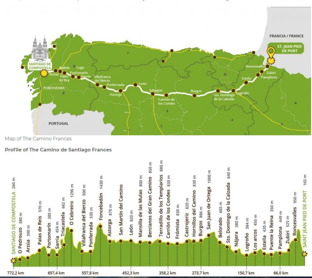
The Camino Francés crosses three mountain ranges with elevations of over 1200m (3,900ft) as well as smaller mountains and ridges. (Cicerone)
Guidebooks typically describe 33-35 stages for the approximately 500 mile pilgrimage between Saint-Jean-Pied-de-Port, France and Santiago de Compostela, Spain. I have planned 39 stages. Additionally, I will continue to Finisterre which adds another 4 stages. The final trip total is:
44 stages + 6 R&R days + 1 travel day (bus back to Santiago from Finisterre)
Total 51 days + 4 days travel to/from Spain.
Access the individual Stage pages by selecting from the dropdown menu at the top of the screen or by scrolling down to click the link at the bottom of this page.
The elevation maps on my Stage pages are taken from a guide provided by the Pilgrim Office in Saint-Jean-Pied-de-Port and is staged in fewer stages than I will take. My stages don’t match their plan so I highlighted my stages in yellow.
The elevation map shown on this page is from the Camino de Santiago Community Forum hosted by Ivar. https://www.caminodesantiago.me/community/
Elevation Gain: 18,666 meters (61,240 feet)
Elevation Loss: 17,778 meters (58,328 feet)